
Road-Tripping the Pacific Coast Highway: Stops, Conditions, and Logistics
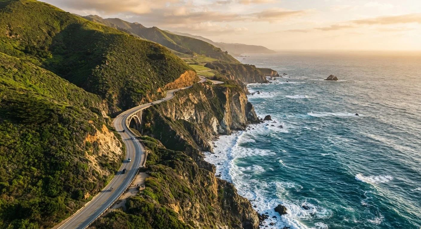
Photo credit: AdvisorHQ.net | Informative Website
In this article
A clear-eyed guide to planning a PCH drive, covering scenic stops, seasonal road conditions, and practical logistics to know in advance.
Key Takeaways
- The PCH spans roughly 656 miles of California coastline; most drivers budget 5-7 days for a comfortable end-to-end drive.
- Big Sur is the most scenically dramatic segment but also the most prone to storm-related closures - always check Caltrans before departing.
- Southbound driving puts you in the ocean-view lane, which many travelers consider the more rewarding direction.
- Lodging along popular segments books out weeks in advance, especially in summer - plan accommodations early.
- Fuel stations thin out considerably between Carmel and San Simeon; top off your tank before entering Big Sur.
What the PCH Actually Is (and Isn't)
California's State Route 1 - widely called the Pacific Coast Highway, or PCH - runs roughly 656 miles along the state's coastline, from Dana Point in Southern California to Leggett in Mendocino County. It is not a single unbroken freeway. The route alternates between multi-lane urban stretches (through Los Angeles and Santa Barbara) and narrow, winding two-lane roads clinging to coastal cliffs. That variety is part of the appeal, but it also means your average speed will vary wildly from one segment to the next.
Most road-trippers focus on the classic central stretch from San Francisco south to Los Angeles - or the reverse - which captures the most celebrated scenery. If you're new to long-haul planning, this first-timer's trip-planning roadmap is a useful starting framework before you dive into PCH specifics.
Highlight Stops Worth Slowing Down For
The PCH rewards deliberate pacing. Here are segments and stops that consistently stand out:
- Monterey Peninsula: The 17-Mile Drive through Pacific Grove and Pebble Beach offers coastal cypress forests and ocean vistas. Entry requires a small per-vehicle toll; verify the current fee before you go.
- Big Sur: The roughly 90-mile stretch between Carmel and San Simeon is the route's crown jewel - dramatic cliffs, redwood canyons, and landmarks like Bixby Creek Bridge and McWay Falls. Expect slow going; this is a road to savor, not speed through.
- San Luis Obispo County: Morro Rock, Pismo Beach, and the elephant seal rookery near San Simeon (where hundreds of seals haul out seasonally) are genuinely memorable.
- Santa Barbara: A natural break point with historic Spanish Colonial architecture, a walkable downtown, and beaches that feel a world removed from the LA metro sprawl to the south.
- Malibu and the Santa Monica Mountains: As you approach LA, dramatic canyon roads and state parks thread inland - worth a detour if you have a day to spare.
Drive southbound if you can - it puts you in the lane closest to the ocean edge, so the views are right out your window rather than across oncoming traffic.
On the Big Sur segment especially, the westward-facing lane offers unobstructed cliff and ocean sightlines that northbound drivers miss from the inland lane.
Set a hard rule to stop at every signed vista point for at least five minutes - even when you think you've seen enough cliffs.
The most iconic PCH viewpoints, including spots overlooking Bixby Creek Bridge, are easy to speed past; planned stops ensure you don't arrive home wishing you'd slowed down.
Building in genuine buffer time between stops prevents the itinerary collapse that plagues PCH first-timers. See common itinerary pitfalls for how over-scheduling ruins otherwise great road trips.
Seasonal Conditions and Road Closures
The PCH is driveable year-round, but conditions shift significantly by season - and closures, particularly in Big Sur, are a real planning factor.
Big Sur Closures Are Common - Plan Accordingly
Storm damage, mudslides, and rockfalls have closed sections of the Big Sur highway for months at a time in recent years. Before departing, check real-time conditions at Caltrans (dot.ca.gov). Don't assume the route is open based on a trip report more than 24 hours old, especially in winter or after significant rainfall.
Winter and spring (November through April) bring the highest risk of storm damage, mudslides, and temporary closures on the Big Sur segment. Caltrans (the California Department of Transportation) maintains a real-time road conditions site at dot.ca.gov - check it before every drive through this area. Closures can last days or months after major events.
Summer is peak season: expect heavy traffic, full campgrounds, and lodging that books out well in advance. June often brings coastal fog (locally called "June Gloom"), which can mute the views until afternoon.
Fall (September through October) is widely regarded as the most reliable window - cleaner skies, thinner crowds, and stable road conditions. If your schedule is flexible, this window is hard to beat.
Whatever time of year you travel, always verify current conditions with official Caltrans resources and check the National Park Service site if you're visiting coastal parks or campgrounds.
Logistics: Pacing, Lodging, and Fuel
Getting the logistics right makes the difference between a trip you'll rave about and one that wears you out.
Pacing
Most travelers underestimate the PCH's time demands. The LA-to-SF drive is roughly 400 miles on this route, but with stops, viewpoints, and slower winding roads, five to seven days is a more realistic budget than two or three. These itinerary-building principles apply directly here: anchor your days around one or two major stops and let smaller moments fill in around them.
Lodging
Big Sur has limited lodging options - a handful of campgrounds, glamping sites, and lodges - and they fill quickly. Book as far in advance as possible, especially for summer travel. Santa Barbara, San Luis Obispo, and Carmel offer broader options at various price points.
Fuel
There are virtually no gas stations between Carmel and San Simeon (roughly 90 miles). Fill your tank before entering Big Sur from either direction. This is not a stretch where you want to gamble on an empty gauge.
~90 miles
Length of the Big Sur coastal stretch
The Big Sur segment between Carmel and San Simeon is the longest and most remote section of the PCH with minimal services.
5-7 days
Recommended days for LA-to-SF PCH drive
Travel experts and experienced road-trippers consistently recommend this range for a comfortable, unhurried end-to-end drive with meaningful stops.
656 miles
Total length of California's State Route 1
California's State Route 1 spans the full length of the state's coastline from Dana Point to Leggett in Mendocino County.
Before You Go: Preparation Essentials
A few practical steps before you depart can prevent the kind of problems that turn a scenic drive into a stressful one.
Make sure your vehicle is road-ready - the PCH includes sustained grades, tight curves, and long stretches without services. A thorough pre-trip safety check is worth doing before any multi-day road trip, and especially one this remote in stretches. Check tire condition, brakes, fluids, and your spare.
Download offline maps for Big Sur - cell service is unreliable through much of that segment. Carry a paper map as backup. Pack more food, water, and snacks than you think you need; services are sparse between major towns.
For the fullest picture of how a PCH drive fits into a broader travel plan, this end-to-end travel planning reference covers everything from booking logistics to on-the-ground prep. The PCH rewards travelers who prepare thoughtfully - and it's the kind of drive that stays with you long after you've returned home.
Road conditions, closures, fees, and regulations mentioned in this article are subject to change. Always verify current information with official sources such as Caltrans (dot.ca.gov), the National Park Service, and relevant local authorities before traveling.

Author
Travel & Trips Editorial Team
Travel & Trips Editorial Team is the collective byline for our editorial team and contributor network. Articles published under this byline or an editorial pen name are researched, written, and reviewed according to our editorial standards for clarity, consistency, and independence before publication.
View all articles →